Bremerhaven (Carl-Schurz Kaserne) - ACE-High-Journal

Hauptmenü:
×
- Start Seite, WebSite
-
ACE-High System, Informationen
- ACE-High, WebSite Index
- Der Kalte Krieg
- ACE-High Network
- ACE-High Network France, die Geschichte
- ACE-High Station Feldberg, ein Zeitdokument
- ACE-High Station Feldberg, Karlsruhe 2.tes Meeting
-
NATO Kommunikation
- Cemetery Network
- CIP 67
- Cronos
- DCS
- Double Jump
- Jocas
- NICS
- Last talk
- Nationale Systeme
- NATO Verbandsabzeichen
- Linienführung
-
Technik
- Technik, Innenbereich
- Technik, Aussenbereich
- Technik, Komponenten
- Formblatt
- Handbücher
- No Break Unit
- Personal
- Warnungen
- Zeichnungen
- Impressum
-
Systeme vor dem ACE-High System
-
AIRCENT
- Info Seite, AIRCENT (1)
- Linienplan, AIRCENT
- Technik (Innen- und Aussenbereich)
- Fontainebleau (Camp AIRCENT HQ)
- A-1. Fontainebleau (Terminal-AIRCENT)
- A-2. Croix d'Augas
- A-3. Melun
- A-4. Jossigny
- A-4. Marly-le-Roi (Terminal-SHAPE)
- A-5. Éméville
- A-6. Margival (Crouy)
- A-6 / D-1. Margival (Laffaux)
- A-7 / D-2. St. Erme
- A-8 / D-3. Poix-Terron (La Bascule)
- B-3. Angevillers (Molvange, Bloc 7)
- Brassoir
- Brüssel-Evere, Terminal NATO HQ
- C-1. Lüttelforst
- C-2. Lammersdorf
- C-3. Roclenge-sur-Geer
- C-4. Baraque-de-Fraiture
- C-5. Vieux Moulins
- Chimay
- D-2. Jonchery-sur-Vesle
- D-4. Liart
- Haraumont
- Mönchengladbach (Terminal - 2. ATAF)
- Perl-Eft
- Plailly
- Trier-Euren (Mohrenkopf)
- Trier-Euren (Terminal Stab-4-ATAF)
-
Sonstige AIRCENT Stationen (2)
- Info Seite, AIRCENT (2)
-
Bann
- La Fèrèe
- Mannheim-Seckenheim (Terminal)
- Marlemont
- Montlhèry
- Münchweiler
- Weiskirchen
-
LANDCENT
- Info Seite, LANDCENT (1)
- Linienplan, LANDCENT
- Technik (Innen-Aussenbereich)
- Bann (Kindsbach)
- Donnersberg
- Fontainebleau (Terminal B-La Madeleine)
- Mannheim-Seckenheim (Terminal B-CENTAG)
- Mönchengladbach (Terminal B-NORTHAG)
- Münchweiler
- R1. Dampleux
- R1 / R1. Marlemont
- R 2. La Haute-Maison
- R 2. Stonne
- R 3. Croix d'Augas
- R 3. Grandmenil
- R 3. Haraumont
- R 4. Angevillers (Bloc 7)
- R 4. Baraque Michel
- R 5. Perl-Eft
- R 6. Freisen
- Soissons (Terminal A)
- Weiskirchen
-
Sonstige LANDCENT Stationen (2)
- Info Seite, LANDCENT (2)
- Feschaux
- Fontainebleau (Camp Guynemer/LANDCENT HQ)
- Heidelberg HQ
- Le Mensil
- 2. Fontainebleau-Maintenace
-
AFCENT/JCA
- Info Seite, AFCENT/JCA (1)
- Linienplan, AFCENT/JCA
- Technik (Innen- Aussenbereich)
- 1- Fontainebleau, AFCENT HQ
- 2. Fontainebleau-Maintenance
- 3. Saint-Méry-Bombon
- 4. Bussières (La Haute-Maison)
- 4. La Haute-Maison
- 5. Dampleux
- 6. Lagery
- 7. St. Erme
- 8. Jossigny
- 9. Éméville
- 10. Margival (Laffaux)
- 11. Wahlhausen (ex 24)
- 12. La Bascule
- 13. Haraumont
- 14. Angevillers
- 15. Weiskirchen
- 16. Bann (Kindsbach)
- 17. Münchweiler
- 18. Marlemont
- 19. Vieux Moulins (AFCENT Site)
- 20. Baraque-de-Fraiture
- 21. Maastricht
- Maastricht-Kanne (Bunker Cannerberg)
- 21. Roclenge-sur-Geer
- 22. Lammersdorf
- 23. Mönchengladbach (Rheindahlen)
-
Sonstige AFCENT/JCA Stationen (2)
- Info Seite, AFCENT/JCA
- Prüm-Air Station (AS)
-
AFCENT/CRICS
- Info Seite, AFCENT/CRICS
- Linienplan, AFCENT/CRICS
- Baraque Michel
- Baraque-de-Fraiture
- Brunssum
- Erbeskopf
- Hornisgrinde
- Kindsbach
- Maastricht, "CENTAG"
-
Baraque Michel
- Maastrichr, "LCO"
- Pirmasens
- Prüm-Post
-
AIRCENT
-
Systeme mit dem ACE-High System
-
DEW System
- Info Seite, DEW
- Linienplan, DEW
- DYE-5, Keflavik
- DYE-4, Kulusuk
-
NARS System
- Info Seite, NARS
- Linienplan, NARS
- Faröer, Site 43
- Flyingdales, Site 46
- Höfn, Site 42
- Keflavik, Site 41
- Mormond Hill, Site 44
-
DEW System
-
ACE-High System
- Info Seite, ACE-High System
-
Bereich, ACCHAN
-
England
- Info Seite, ACCHAN
- Linienplan, ACCHAN
- Aberdeen
- Aberdeen Tail
- Binbrook
- Boulmer
- Faroes
- London
- London Tail
- London Tail Relay
- Shetlands
- Shetlands Tail
- Shetlands Tail Relay
-
England
-
Bereich, AFNORTH
-
Dänemark
- Info Seite, AFNORTH
- Linienplan, AFNORTH
- Kollemorten
- Lundebakke
-
Norwegen
- Info Seite, AFNORTH
- Linienplan, AFNORTH
- Konferenz, AFNORTH
- Bodø
- Bodø Tail
- Kolsås
- Høggumpen
- Kristiansand
- Lysenut
- Mågerø
- Mosjøen
- Oslo
- Senja
- Svartås
- Trondheim
- Trondheim Tail
-
Dänemark
-
Bereich, AFCENT
-
Belgien
- Info Seite, AFCENT
- Linienplan, AFCENT
- Adinkerke
- Baraque-de-Fraiture
- Casteau (SHAPE)
- Chievres
-
Deutschland
- Info Seite, AFCENT
- Linienplan, AFCENT
- Aurich
- Feldberg
- Hehn
- Kindsbach
- Lammersdorf
- Moenchen-Gladbach, Teil (2) (Millen)
- Uedem
-
Frankreich
- Info Seite, AFCENT
- Linienplan, AFCENT
- Éméville
- Lyon
- Nice
- Paris North
- Paris South
- Paris Tail (1), Laffaux
- Paris Tail (2), Extension-SHAPE
- Paris Tail (2), St. Germain
- Paris, Tour Eiffel control center
- Rohrbach
- Rozoy-Bellevalle
- Taverny
-
Niederlande
- Info Seite, AFCENT
- Linienplan, AFCENT
- Brunssum
- Maastricht
-
Belgien
-
Bereich, AFSOUTH
-
Griechenland
- Info Seite, AFSOUTH
- Linienplan, AFSOUTH
- Athens
- Athens Tail
- Ismaros
- Kefallonia
- Larissa
- Larissa Tail
- Vitsi
- Ziros
-
Italien
- Info Seite, AFSOUTH
- Linienplan, AFSOUTH
- Aviano Lame Tail
- Catanzaro
- Cavriana
-
Dosso dei Galli
- Dosso dei Galli (1)
- Dosso dei Galli (2)
- Beschreibung (Deutsche-Version)
- Beschreibung (Versione-italiana)
- Bilddokumentationen 1969>1974
- Bilddokumentationen 1975>2004
- Bilddokumentationen 2005>2009
- 2009, Anniversary 40 Jahre
- Bilddokumantationen 2010>2019
- 2019, Anniversary 50 Jahre
- Bilddokumentationen 2020>heute
- Publikationen
- Lame Concordia
- Latina School
- Livorno
- Malta (Gharghur)
- Malta (Floriana)
- Martina Franca
- Monte Iacotenente
- Monte Lauro
- Monte Petrino
- Monte Vergine
- Monte Vulture
- Naples
- Pietra Ficcata
- Rome
- Rome Tail
- Verona Tail
- Verona Torre 4
-
Italien NTTS
- Info Seite, NTTS System
- FTASE, Alliierte Landstreitkräfte Südeuropas
- Nationaler Linienplan
- Affi, Bunker West Star, Site B
- Aviano, Air Base
- Brescia, Monte Maddalena, Site D
- Cansiglio, Site G
- Cavriana
- Collio, Dosso dei Galli
- Comano, Livorno
- Comerlati, Monte Comerlati, Site W
- Comiso, Air Base
- Concordia Sagittaria, Lame Concordia
- Crosara, Monte Alto, Site E
- Ghedi, Air Base
- Grezzana, Bunker Back Yard, Site A
- Lughenzzano, SatCom F14
- Milano
- Motta di Livenza
- Nisidia, Navy HQ NAVSOUTH
- Negrar, Monte Tondo
- Padua, Monte Venda
- Piacenza, Air Base
- Piancavallo, Site J
- Poggio Renatico
- Romano d`Ezzelino, La Gusella, Site F
- Site M (nicht aktiviert)
- Solbiate Olana
- Treviso-Istrana, Air Base
- Treviso-Sant Àngelo, Air Base
- Verona, Palazzo Carli
- Vicenza, Air Base, 5 ATAF
- Villafranca di Verona, Air Base
- Vittoria Veneto
- Volta Mantovana, Air Force, Site C
-
Türkei
- Info Seite, AFSOUTH
- Linienplan, AFSOUTH
- Adana
- Adana Tail
- Amasra
- Ankara
- Ankara Tail
- Cyprus
- Diyarbakir
- Diyarbakir Tail (Air Base)
- Eskisehir
- Eskisehir Tail
- Izmir
- Izmir Tail
- Mardin
- Merzifon
- Pazar
- Persembe
- Sivas
-
Griechenland
-
Sonstige Systeme
-
BARS "БАРС" Schneeleopard
- Info Seite, BARS
- Übersichtsplan, BARS
- Lindholz, Bunker 302 (Eichenthal)
-
BAOR/RAF Germany
- Info Seite, BAOR/RAF
- Übersichtsplan, BAOR/RAF
- Arsbeck
- Bielefeld (Ebberg)
- Bielefeld (Hünenburg)
- Birgelen
- Brüggen
- Deister (Annaturm)
- Dörenberg (BFBS)
- Groß Gusborn (BFBS)
- Hehn
- Hostert, Britisch Military Hospital
- Krefeld
- Lübbecke ridge BFBS Transmitter (Holsen)
- Mönchengladbach
- Roetgen (Lammersdorf)
- Schwalmtal, HQ NAAFI Waldniel
- St.Tönis, Francisca Barracks
- Weeze-Laarbruch, RAF Air Base
- Wegberg, RAF Hospital
- Wildenrath, RAF Air Base
- Willich, Kitchener Barracks
-
Echolon Netzwerk
- Info Seite, Echolon
- Ayios Nikolaos Station, Cyprus
- Bad Aibling
- Berlin, Teufelsberg
-
ET-A System
- Info Seite, ET-A
- Linienplan, ET-A
-
Belgien
- Info Seite, Belgien
- Ben-Ahin
- Casteau
- Chièvres
- Flobecq
- Houtem
- Le Chenoy
- Spa-Malchamps
- Westrozebeke
-
Deutschland
- Info Seite, Deutschland
- Adenau (Raßberg)
- Berlin, Dahlem
- Berlin, Marienfelde
- Berlin, Olympiastation
- Berlin, Schäferberg
- Berlin, Tempelhof
- Berlin, Teufelsberg
- Bocksberg
- Breitsol
- Bremerhaven (Carl-Schurz Kaserne)
- Donnersberg
- Feldberg (Schwarzwald)
- Feldberg (Taunus)
- Heidelberg
- Hohenpeissenberg
- Hohenstadt
- Holzminden, Köterberg
- Linderhofe
- Munich
- Nuernberg
- Schönfeld (Prüm Air)
- Stein
- Wunstorf, Air Base
- Zugspitze
-
England
- Info Seite, England
- Martlesham Heath
- RAF Fylingdales
-
Frankreich
- Info Seite, Frankreich
- Camp Bussac
- Dreux-Louvilliers, Air Base
- Maison Fort
- Nancy, Emergency Airfield
- Paris (Camp des Loges)
- Vatry, Air Base
-
Niederlande
- Info Seite, Niederlande
- Hoeck van Holland
-
RAF UK > BAOR, Scatterlink
- Info Seite, Scatterlink
- Linienplan, Scatterlink
- Roetgen (Deutschland)
- Swingate (England)
-
Royal Air Force, UK
- Info Seite, RAF UK
- Linienplan, RAF UK
- Bulbarrow Hill
- Dean Hill
- Fylindales Moor
- Golden Pot Towers
- High Wycombe Air Base
- HQ Northwood
-
Royal Air Force, Cyprus
- Info Seite, RAF Cyprus
- Linienplan, RAF Cyprus
- Akrotiri
- Akrotiri, Dekalia
- Ayios Nikolaos Station
- Cyta Yeroskipos
- Lincolnshire Poacher
- Troodos
-
Medcom System, 486L
- Info Seite, 486L Medcom
- Linienplan, 486L Medcom
-
England
- Info Seite, England
- Ringstead Bay
-
Griechenland
- Info Seite, Griechenland
- Levkas, Site 14B
- Mount Edheri, Site 24D
- Mount Pateras, Site 15H
-
Italien
- Info Seite, Italien
- Cima Gallina, Site 120
- Cima Grappa
- Cima Paganella
- Coltano, Site 9L
- Martina Franca, Site 7A
- Monte Cimone
- Monte Corna
- Monte Limbara, Site 4C
- Monte Nardello, Site 6E
-
Monte Vergine, Site 5F
- Monte Vergine, Site 5F
- Padua, Monte Venda
- Savona, Site 56
- Sigonella
-
Spanien
- Info Seite, Spanien
- Gorramendi, Site 163
- Guardamar, Site 33
- Humosa, Site 1A
- Inogès, Site 21
- Menorca, Site 3B
- San Pablo, Site 108
- Mallorca, Site 3H
-
Türkei
- Info Seite, Türkei
- Adana, Site 129
- Balikesir, Site 32
- Elmadağ, Site 142
- Malatya, Site 105
- Şahin Tepesi, Site 30G
- Samsun, Site 137
- Sinop, Site 121
- Yamanlar, Site 16D
-
BARS "БАРС" Schneeleopard
Sonstige Systeme > ET-A System > Deutschland > Bremerhaven (Carl-Schurz Kaserne)
Sonstige Systeme von 1966
(ET-A European Tropospheric Scatter-Army System)
_____________________________________________________________________________________________________________________________________________________________________________

Bremerhaven
- Bremerhaven (Carl-Schurz Kaserne)
- Bremerhaven Terminal Station (BRN)
- European Tropospheric Scatter – Army (ET-A), Nodal Site 52
53°35'10.34"N/8°33'05.37"O - 2 m.üNN
Antennen üGND : Tower, Höhe unbekannt
Site Code : BRN
Nodal Site : 52
Status : Aufgegebene Nutzung
Status heute : unbekannt
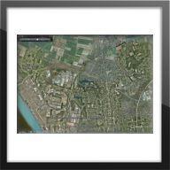
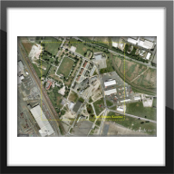
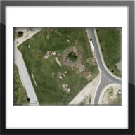
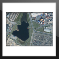
Ansicht : Geographische Ansicht (1)
___________________________________________________________________________________________________________________________________________________________________________________________________________
Übersichtspläne - Bezeichnungen - Transmitterverbindungen
Linienplan (ET-A Microwave Communication System)
___________________________________________________________________________________________________________________________________________________________________________________________________________
Beschreibungen
Link Seiten, Wikipedia
"Bremerhaven ist eine kreisfreie Stadt am Westrand des Elbe-Weser-Dreiecks, das in die Nordsee übergeht. Als Exklave gehört sie zum Land Freie Hansestadt Bremen. Die Großstadt ist Teil der Metropolregion Nordwest. Landseitig umschlossen ist sie vom Landkreis Cuxhaven, für den sie das Oberzentrum darstellt. " [4]
___________________________________________________________________________________________________________________________________________________________________________________________________________
"Die Carl-Schurz Kaserne in Bremerhaven ist seit mehreren Jahrzehnten die Heimat von Einheiten der US-Armee, darunter Elemente der 2nd Armored Division (Forward). Heute beherbergt es Transporteinheiten der Armee und einige zivile kommerzielle Aktivitäten im Zusammenhang mit der kommerziellen Schifffahrt." [5]
___________________________________________________________________________________________________________________________________________________________________________________________________________
Hintergrundinformationen
"Although northwest Germany was to become a British occupation zone, an exclave was granted to the US Army in the area between Bremen and Nordholz. The US needed a support point with a harbour, to allow the unhindered support of US forces in the American Occupation Zone in Southern Germany. The US Army moved into the airfield as early as May 1945, and used the port to return troops from Europe to the United States. Until 1947 the US airforce also used the Nordholz Airbase.
Initially several locations were used by the Americans, but over time they were reduced in number until by the 1960s they all merged into the joint location referred to as the "Staging Area" and became home to units of the US Army Terminal Command, Europe (USATCEUR), US Navy, US Coast Guard and US Air Force. In 1973 the barracks were renamed Carl Schurz Barracks.After the Cold War ended the US reduced their presence in Germany. In an effort to further reduce costs most of the goods were sent through the Dutch port of Rotterdam, ending the need for Bremerhaven. This ended the American presence and the military units were withdrawn in 1993, leaving only a small civilian contignent to coordinate the remaining transshipments.Today, the former airfield has been redeveloped into a large storage yard for the Bremerhaven shipping facilities." [5]
___________________________________________________________________________________________________________________________________________________________________________________________________________
___________________________________________________________________________________________________________________________________________________________________________________________________________
_____________________________________________________________________________________________________________________________________________________________________________
Bild - Quellenangaben
(1) Geographische Ansicht
(1) Google Earth, Google Street
(2) Wikipedia, Logo
(3) Wikipedia, Datei:Geestemuendung-in-Weser-Bremerhaven-2012-05-RaBoe-060.jpg
(4) Wikipedia, Datei:Usarmy-bremerhaven-09 hg.jpg
"ace-high-journal.de" - alle Rechte bei WebMaster - Online seit 01.01.2009


