Brescia, Monte Maddalena, Site D - ACE-High-Journal
Hauptmenü:
- Homepage
-
AIRCENT 1952 > 1958
- Info Seite
- AIRCENT Linienplan
- Technik (Innen- Aussenbereich)
- Fontainebleau / Camp AIRCENT
- A-1. Fontainebleau / Terminal (AIRCENT)
- A-2. Croix d'Augas
- A-3. Melun
- A-4. Jossigny (s.Index)
- A-4. Marly-le-Roi / Terminal (SHAPE)
- A-5. Éméville
- A-6. Margival (Crouy)
- A-6 / D-1. Margival (Laffaux)
- A-7 / D-2. St. Erme
- A-8 / D-3. Poix-Terron (La Bascule)
- B-3. Angevillers (Molvange)
- Brassoir (s.Index)
- Brüssel-Evere / Terminal (NATO)
- C-1. Lüttelforst
- Mönchengladbach / Terminal (2. ATAF)
- C-2. Lammersdorf
-
LANDCENT 1952 >1962
- Info Seite
- LANDCENT Linienplan
- Technik (Innen- Aussenbereich)
- Bann (Kindsbach)
- Donnersberg
- Fontainebleau / Terminal B (LANDCENT)
- Mannheim / Terminal B (CENTAG)
- Mönchengladbach / Terminal B (NORTHAG)
- Münchweiler
- R 1. Dampleux
-
AFCENT/JCA 1962 >1967
- Info Seite
- AFCENT Linienplan
- Technik (Innen- Aussenbereich)
- 1. Fontainebleau, AFCENT HQ
- 2. Fontainebleau - Maintenance
- 3. St. Méry-Bombon
- 4. Bussières (La Haute-Maison)
- 4. La Haute-Maison
- 5. Dampleux
- 6. Lagery
- 7. St. Erme
- 8. Jossigny
- 9. Éméville
- 10. Margival (Laffaux)
- 11. Wahlhausen (ex St.24)
- Camp de Margival, AFCENT WHQ
- 12. Poix-Terron (La Bascule)
- 13. Vilosnes-Haraumont
- 14. Angevillers
- 15. Weiskirchen
- 16. Bann (Kindsbach)
- 17. Münchweiler
- 18. Marlemont
- 19. Vieux Moulins
- 20. Baraque-de-Fraiture
- 21. Maastricht
- Maastricht-Riemst (Bunker "Cannerberg")
- 21. Roclenge-sur-Geer
- 22. Lammersdorf
- 23. Rheindahlen
- Sonstige Stationen
- AFCENT CRICS 1967 >1979
-
AFCENT CIP 67, ab 1967
- Info Seite
- CIP 67 Linienplan
- Technik (Innen- Aussenbereich)
- Arnheim
- Aurich
- Bad Bergzabern (1) alte Liegenschaft
- Bad Bergzabern (2) neue Liegenschaft
- Baden-Söllingen
- Baraque-de-Fraiture
- Barnsdorf
- Battice (Fort)
- Beckum
- Bielefeld (Ebberg)
- Böblingen
- Bonn (Hardthöhe)
- Brockzetel
- Brunssum
- Damme
- Dietenwengen
- Dötlingen
- Drabenderhöhe
- Ellerspring
- Erbeskopf
- Börfink (Bunker-"Erwin")
- Euskirchen
- Feldberg
- Gross Reken
- Hehn
- Herkenbosch
- Himmelsberg
- Hochkelberg
- Hornisgrinde
- Ibbenbüren
- Irndorf
- Kesternich
- Kindsbach
- Kindsbach (Bunker-"Cave")
- Kolbenberg
- Lammersdorf
- Langerkopf
- Lantin
- Leistadt
- Leopoldsburg
- Lübbecke
- Maastricht
- Maastricht - Riemst (Bunker-"Cannerberg")
- Markelo
- Meßstetten
- Meßstetten (Bunker-"Martin")
- Mönchberg
- Münchweiler [Ruppertsweiler]
- Nordhelle
- Nottuln
- Oberabtsteinach
- Obertshausen
- Oldenburg
- Ottenstein
- Pirmasens-Husterhöhe
- Potzberg
- Prüm - Post (Air)
- ACE-High-System Europa
-
ACE-High-System, ACCHAN,ab 1958
- Info Seite
- England
-
ACE-High-System, AFNORTH,ab 1958
- Info Seite
-
Dänemark
- ACE-High System
- Sonstige Objekte
- Norwegen
-
ACE-High-System, AFCENT,ab 1958
- Info Seite
- Link Seiten-Übersicht
-
Deutschland
- ACE-High System
-
Exkursionen (D)
- Info Seite (D)
- Bonndorf - Wutachschlucht
- Freiburg - Bodensee Querweg
- Freudenstadt - Rothirschweg
- Freudenstadt - Holzmichelweg
- Hinterzarten - Ravennaschlucht
- Hinterzarten - rund um den Feldberg
- Kniebis - Lotharpfad
- Lübeck - Stralsund Ostseeradweg
- Pforzheim - Mittelweg
- Pforzheim - Ostweg
- Pforzheim - Westweg
- St Georgen - Pforzheim Wanderweg E8
- Stühlingen - Wehr Schluchtensteig I
- Stühlingen - Wehr Schluchtensteig II
- Triberg - Uhrenträgerweg
- Vossenack - Hürtgenwaldmarsch
- Exkursionen (SP)
- Gedenkstätten
-
Militärische Objekte
- Info Seite
- Air Base
- Bunker, nach WK II
- Munitionslager
- Nike FlaRak Stellungen
- NVA Stellungen
- Pershing FlaRak Stellungen
- Polygone Stellungen
- Transmitter
- Truppenübungsplatz-Kasernen
- U.S. Stellungen
-
WKII Objekte
- Info Seite
- Aurich - Flakstellung
- Bad Bergzabern - Museum
- Bad Münstereifel - FHQ "Felsennest"
- Gemünd - NS-Ordensburg Vogelsang
- Gemünd - Igel Stellung Vogelsang
- Kniebis - FHQ "Tannenberg"
- Lammersdorf - Höckerlinie
- Langschoß - Wasserbunker
- Niedersimten - Museum Gerstfeldhöhe
- Paustenbach - Eifelkreuz
- Schmithof - Höckerlinie
- Seebach (Hornisgrinde) - LVZ
- Simonskall - Museum Sanitätsbunker
-
Städte/Ortschaften
- Info Seite
- Baden-Württemberg
- Bayern
- Berlin
- Brandenburg
- Bremen
- Hamburg
- Hessen
- Mecklenburg-Vorpommern
- Niedersachsen
- Nordrhein-Westfalen
- Rheinland-Pfalz
- Saarland
- Sachsen
- Sachsen-Anhalt
- Schleswig-Holstein
- Thüringen
-
Sonstige Objekte
- Info Seite
- Calmbach - Klinik Charlottenhöhe
- Dannenfels - Ludwigsturm
- Feldberg - Horst Garbe
- Feldberg - Schwarzwald
- Feldberg - Taunus
- Karlsruhe - 2.tes Meeting
- Kniebis - Hotel Alexanderschanze
- Langschoß - Feuerwachtturm
- Mönchengladbach - Flughafen
- Mülheim - Flughafen
- Schwalmtal - Fabrikanlage
- Sinsheim - Technikmuseum
- Viersen-Süchteln Irmgardiskapelle
- Viersen-Süchteln Kriegerdenkmal
- Viersen-Süchten Wasserspeicher
- Weeze - Schloss Wissen
- Wollseifen - das Dorf
- Zivile Bunker
-
Zivile Transmitter
- Info Seite
- Alexanderschanze - Transmitter (Mobil)
- Baden-Baden, Merkurturm
- Bambergerhof - BNetzA Peiler
- Bremen Woltmershausen
- Bremen - Fernmeldeturm
- Dannenfels - Sender Donnersberg
- Düsseldorf - Rheinturm
- Gernsbach - Hohloh
- Gollenberg
- Großhau - Fernmeldeturm
- Lauschied
- Mönchengladbach - FMT
- Nettetal-Hinsbeck
- Nottuln - WDR Sender
- Ober-Abtsteinach - HR
- Reichweiler
- Schiefbahn - Fernmeldeturm
- Schömberg - Sender Langenbrand
- Seebach (Hornisgrinde) - Mobilfunk
- Seebach (Hornisgrinde) - SWR
- Seebach (Hornisgrinde) - Telekom
- Staffel - FMT
- Sulzbach-Rosenberg - Mobilfunk
- Sulzbach- Rosenberg
- Viersen-Bockert
- Viersen-Süchteln - Fernmeldeturm
- Waldböckelheim
- Wildeshausen
- Würselen- Mobilfunk
-
Belgien
- ACE-High System
- Gedenkstätten
-
Militärische Objekte
- Info Seite
-
Transmitter, BEMILCOM
- Info Seite
- Adinkerke, Site 030
- Ben-Ahin, Site Mx
- Battice, Site 024
- Brüssel-Evere / Terminal (NATO)
- Camp Elsenborn
- Court-Saint-Etienne, Site Mx
- D`Hoppe, Site Mx
- Everberg, Site 115
- Genk
- Hannut, Site 055
- Kester-Heide, Site 251
- Kester-Heide, Site Mx
- Langemark
- Latin, Site Mx
- Molenbeek (Site Mx)
- Millen, Site 056
- Millen, Site Mx
- Truppenübungsplatz-Kasernen
- WKI Festungen
- WKII Bunker
- WKII Festungen
- Städte/Ortschaften
- Sonstige Objekte
- Zivile Transmitter
-
Niederlande
- ACE-High System
- Gedenkstätten
- Militärische Objekte
- Städte/Ortschaften
- Sonstige Objekte
-
Frankreich
- ACE-High System
- Gedenkstätten
-
Militärische Objekte
- Info Seite
- Objekte-WKI
- Objekte-WKII
-
Objekte-Maginot-WKII
- Ligne Maginot Übersicht
- 8 S.F. de la Crusnes
-
9 S.F. de Thionville
- Ligne Maginot Übersicht
- 9 S.F. Thionville Übersicht
- Rochonvillers - Abri du Grand Lot
- Angevillers - Camp d`Angevillers
- Rochonvillers - Casemate d`Escherange Ouest
- Rochonvillers - Casemate du Grand Lot
- Rochonvillers - Blockhaus 1 - du Petit Lot
- Rochonvillers - Blockhaus 2 - du Petit Lot
- Rochonvillers - G.O. Rochonvillers Bloc 9
- Rochonvillers - G.O. Rochonvillers
- 10 S.F. de Boulay
- 12 S.F. de la Sarre
- 13 S.F. de Rohrbach
- 14 S.F. des Vosges
-
15 S.F. de Haguenau
- Ligne Maginot Übersicht
- 15 S.F. de Haguenau Übersicht
- Birlenbach - Abri de tir de Birlenbach
- Bremmelbach - Casemate Nord
- Drachenbronn - Casernement de Drachenbronn
- Drachenbronn - G.O. Hochwald Est
- Drachenbronn - G.O. Hochwald Ouest
- Hatten - Abri de Hatten
- Hatten - Abri de tir
- Hatten - Casemate Esch
- Hatten - Casemate la Selz
- Hatten - Observatoire
- Oberhof - G.O. Schoenenbourg
- Pfaffenschlick - Abri de tir Pfaffenschlick Sud
- Rittershoffen - Casemate du Bois 1
- Rittershoffen - Casemate du Bois 2
- Rittershoffen - Casemate du Bois 3
- Polygone Stellungen
- Städte/Ortschaften
- Sonstige Objekte
-
ACE-High-System, AFSOUTH,ab 1958
- Info Seite
- Link Seiten-Übersicht
-
Italien
- ACE-High System
- Exkursionen
-
Militärische Objekte
- Info Seite
- Festungswerke
- La grande Guerra
-
Städte/Ortschaften
- Info Seite
- Affi, Bastia San Michele
- Allumiere
- Agrigento
- Bagolino
- Breno
- Brescia
- Catania
- Collio
- Carrara
- Civitavècchia
- Firenze
- Genova
- Isola di Capri
- Isola di Ischia
- Isola di Procida
- Lago di Garda
- Lago di Idro
- Lago di Iseo
- Lago di Ledro
- Lerici
- Milano
- Monte Etna
- Monte Vesuvio
- Napoli
- Paestum
- Pompeji
- Pozzuoli
- Pisa
- Roma
- Savona
- Sicilia
- Siracusa
- Tuscania
- Tolfa
- Viareggio
- Venezia
- Viterbo
-
Locales NATO / NTTS System
- Info Seite
- Nationaler Linienplan
- Affi, "West Star", Site B
- Aviano, Air Base
- Brescia, Monte Maddalena, Site D
- Cansiglio, Site G
- Cavriana, Site ACE-High
- Collio, Dosso dei Galli, ACE-High
- Comano, Livorno, ACE-High
- Comiso, Air Base
- Concordia Sagittaria, ACE-High
- Erbezzo (Vaccamozzi), Rx Site, Site R
- Ghedi, Air Base
- Grezzana, "Back Yard", Site A
- La Gusella, Site F
- Lughezzano, SatCom F14
- Milano
- Monte Alto (VI), Site E
- Monte Comerlati (VR), Site W
- Motta di Livenza
- Negrar, Monte Tondo
- Padua, Monte Venda
- Piacenza, Air Base
- Pian Cavallo, Site J
- Poggio Renatico
- Sant`Anna D`alfaedo, Tx Site, Site T
- Site M (nicht aktiviert)
- Solbiate Olona
- Treviso - Istrana, Air Base
- Treviso - Sant Àngelo, Air Base
- Verona, Palazzo Carli
- Vicenza, Air Base, 5 ATAF
- Villafranca, Air Base
- Vittorio Veneto
- Volta Mantovana, Site C
-
Griechenland
- ACE-High System
- Städte/Ortschaften
- Türkei
-
NATO CRC, Kommandostand
- Info Seite
- Bunker Übersichtsplan
- England
- Norwegen
- Dänemark
-
Deutschland
- Bodenmais, Luftraumüberwachung (Großer Arber)
- Börfink, Bunker "Erwin"
- Brockzetel, Bunker "Balduin"
- Elmenhorst, Luftraumüberwachung
- Erndtebrück, Bunker "Erich"
- Lauda-Königshofen, Bunker "Gustav"
- Linnich, Bunker "Castlegate"
- Meßstetten, Bunker "Martin"
- Ruppertsweiler, Bunker "Arius-RUF"
- Schönewalde, CRC Bunker "Harald"
- Uedem, Bunker "Udo"
-
Belgien
- Bassenge-Glons, Site CRC
- Mons-Casteau, Bunker "SHAPE Command Center"
- Niederlande
- Frankreich
- Griechenland
- Spanien
-
Italien
- Nationaler Linienplan
-
Affi, Bunker "Weststar"
- Affi, Bunker "Weststar"
- Affi, Bunker "Weststar" Bilddokumentationen 2008-2011
- Affi, Bunker "Weststar" Bilddokumentationen 2016-2019
- Affi, "Weststar" Publikationen
- Affi, Bunker "Monte Moscal"
- Affi, Bunker "San Michele"
- Affi, Heliport Albare
- Erbezzo (Vaccamozi), Rx Site, Site R
- Sant`Anna D`alfaedo, Tx Site, Site T
- Grezzana, Bunker "Back Yard"
- Mondragone, Bunker "Proto"
- Martina Franca, Bunker "3° ROC"
- Padua, Bunker "Monte Venda" 1° ROC
- Rocca di Papa, Bunker "Monte Cavo" 2° ROC
- Sant `Oreste, Bunker "Monte Soratte"
- Türkei
- NATO CAOC, Kommandostand
- NADGE System
- Schweiz, Festungswerke
- NATO SatCom, ab 1968
- RAF UK
-
RAF UK > BAOR, Scatterlink
- Info Seite
- Deutschland
- England
-
BAOR Germany
- Info Seite
- BAOR Übersichtsplan
- Arsbeck, BAD Sub-Depot
- Arsbeck, Rifle Range
- Arsbeck, Training Area
- Birgelen, BFBS Transmitter
- Birgelen, Fernmeldeanlage
- Birgelen, Mercury Barracks
- Brüggen-Bracht, Munitionsdepot
- Brüggen-Elmpt, Air Base Ammunition Compound
- Brüggen-Elmpt, Air Base, Javelin Barracks (Elmpt Station)
- Brüggen-Elmpt, Transmitter
- Hostert, British Miliary Hospital ( Kent School)
- Krefeld, Richtfunk
- Krefeld, Rifle Range
- Krefeld, Bradbury Barracks
- Krefeld, Haynes Barracks
- Lammersdorf, Roetgen
- Mönchengladbach, Rotunda Barracks
- Mönchengladbach, Rotunda Barracks Annex
-
ET-A, Scope Comm, ab 1966
- Info Seite
- ET-A Linienplan
- Belgien
- Deutschland
- England
- Frankreich
- Niederlande
-
486L Medcom, ab 1960
- Info Seite
- 486L Linienplan
- England
- Griechenland
- Italien
- Spanien
- Türkei
- News - Gästebuch Impressum
- Info Seite
- Nationaler Linienplan
- Affi, "West Star", Site B
- Aviano, Air Base
- Brescia, Monte Maddalena, Site D
- Cansiglio, Site G
- Cavriana, Site ACE-High
- Collio, Dosso dei Galli, ACE-High
- Comano, Livorno, ACE-High
- Comiso, Air Base
- Concordia Sagittaria, ACE-High
- Erbezzo (Vaccamozzi), Rx Site, Site R
- Ghedi, Air Base
- Grezzana, "Back Yard", Site A
- La Gusella, Site F
- Lughezzano, SatCom F14
- Milano
- Monte Alto (VI), Site E
- Monte Comerlati (VR), Site W
- Motta di Livenza
- Negrar, Monte Tondo
- Padua, Monte Venda
- Piacenza, Air Base
- Pian Cavallo, Site J
- Poggio Renatico
- Sant`Anna D`alfaedo, Tx Site, Site T
- Site M (nicht aktiviert)
- Solbiate Olona
- Treviso - Istrana, Air Base
- Treviso - Sant Àngelo, Air Base
- Verona, Palazzo Carli
- Vicenza, Air Base, 5 ATAF
- Villafranca, Air Base
- Vittorio Veneto
- Volta Mantovana, Site C
Locales nationales NATO System in Nord-Italien
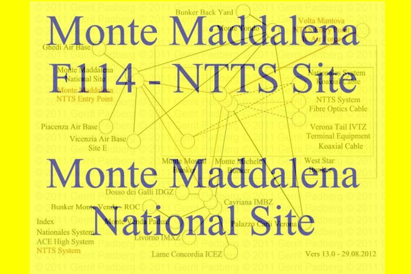
Basisseite "Locales nationales NATO System" - Monte Maddelena - National Site + NTTS Site
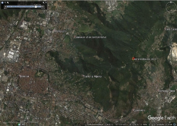
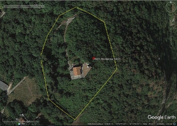
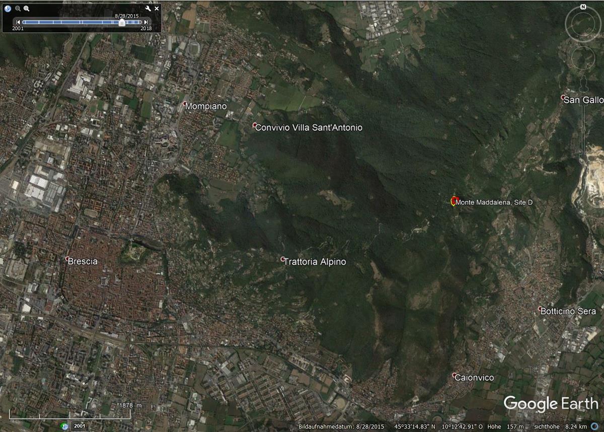
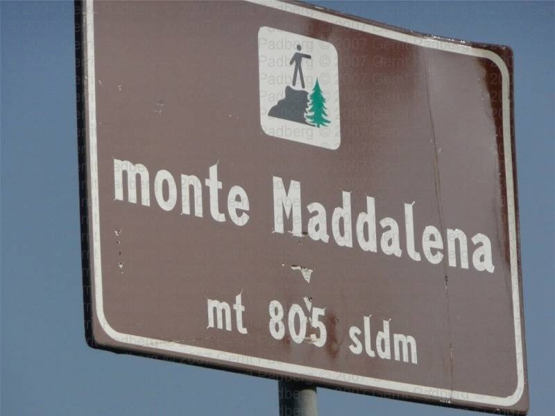
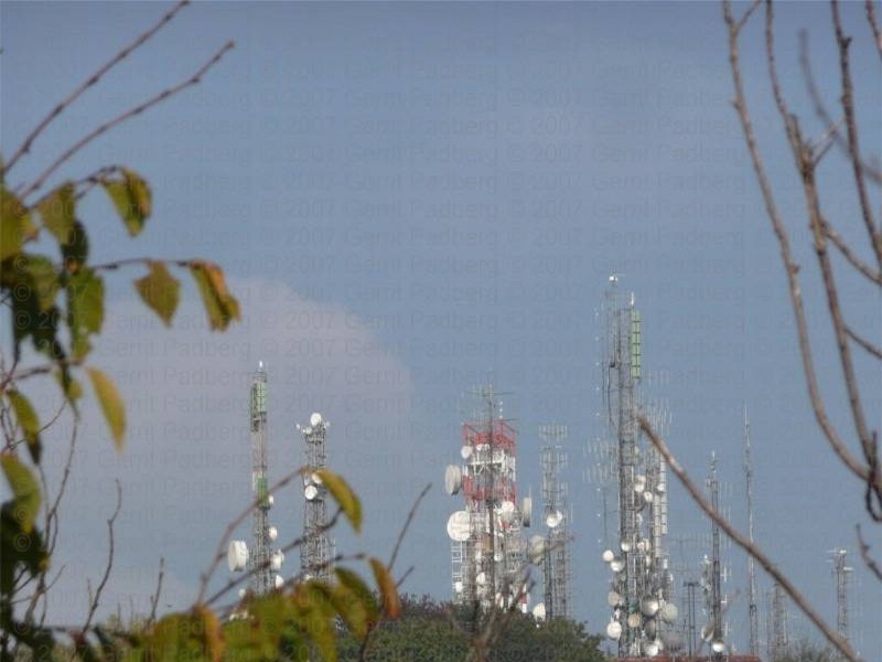
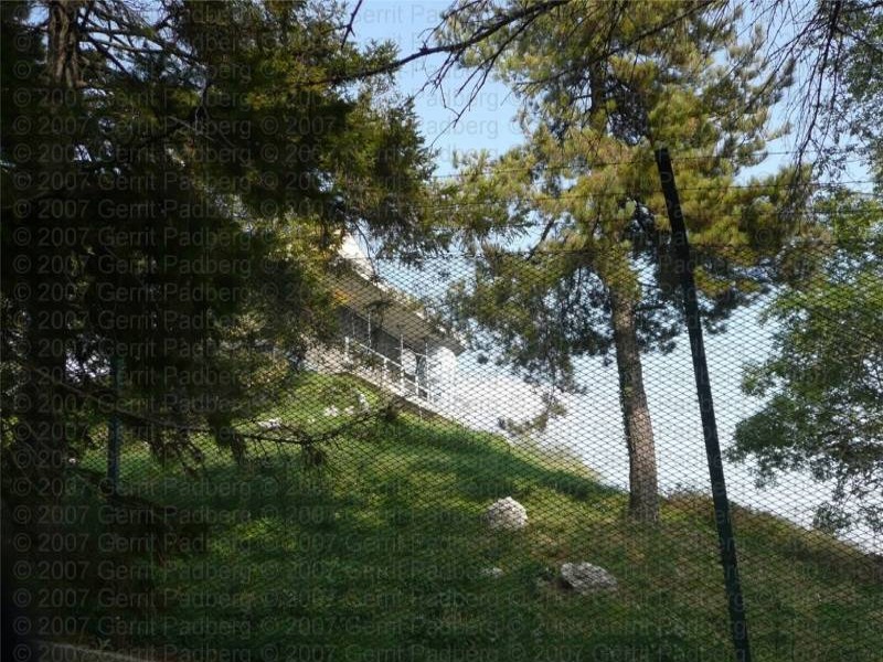
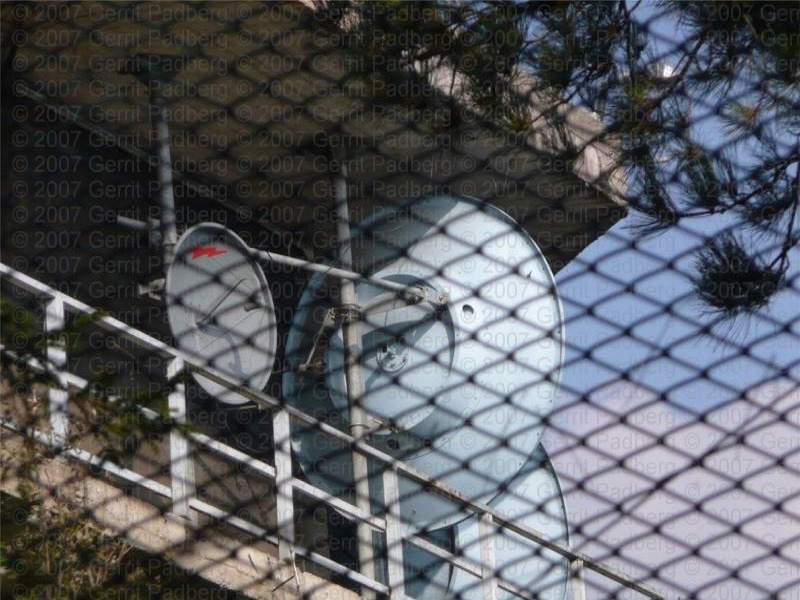
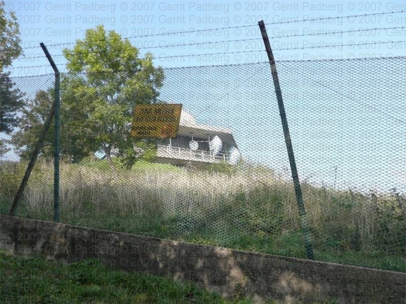
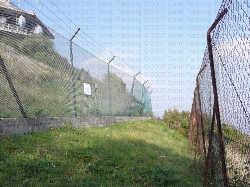
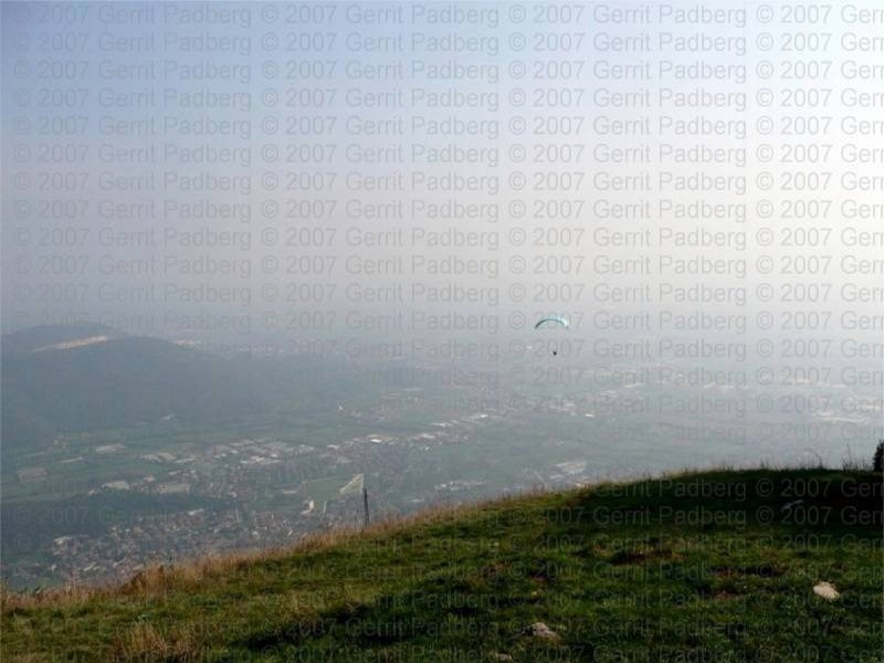
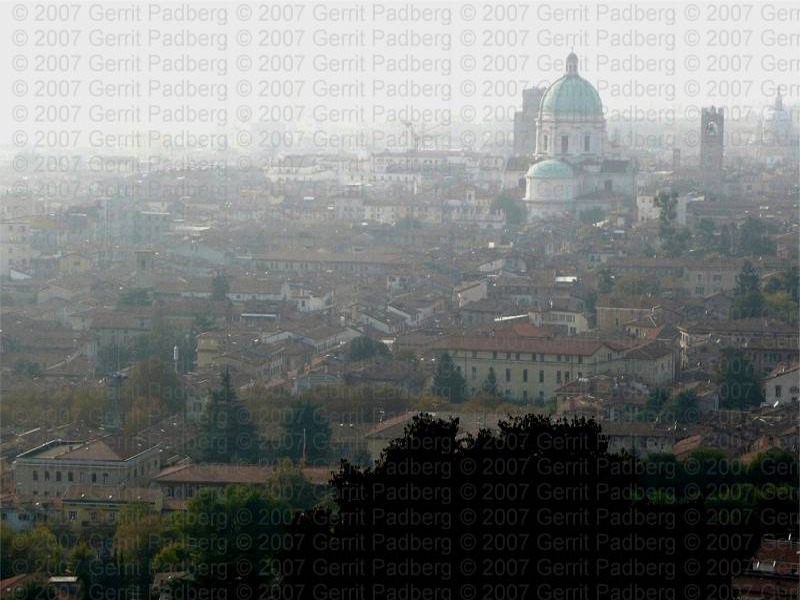
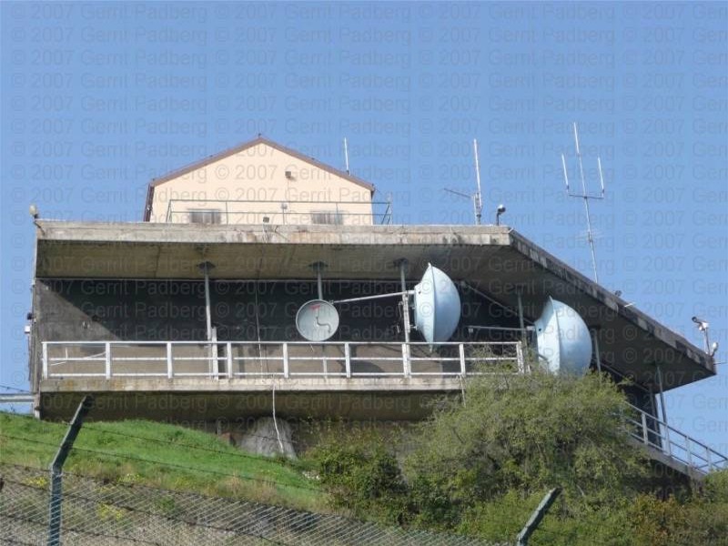
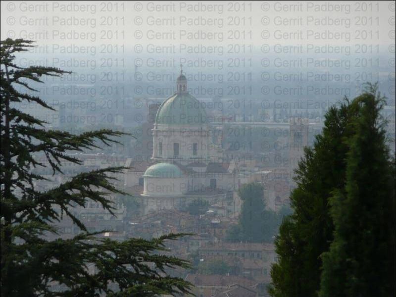
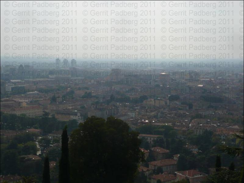
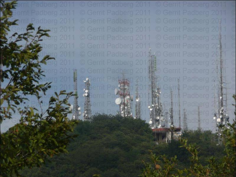
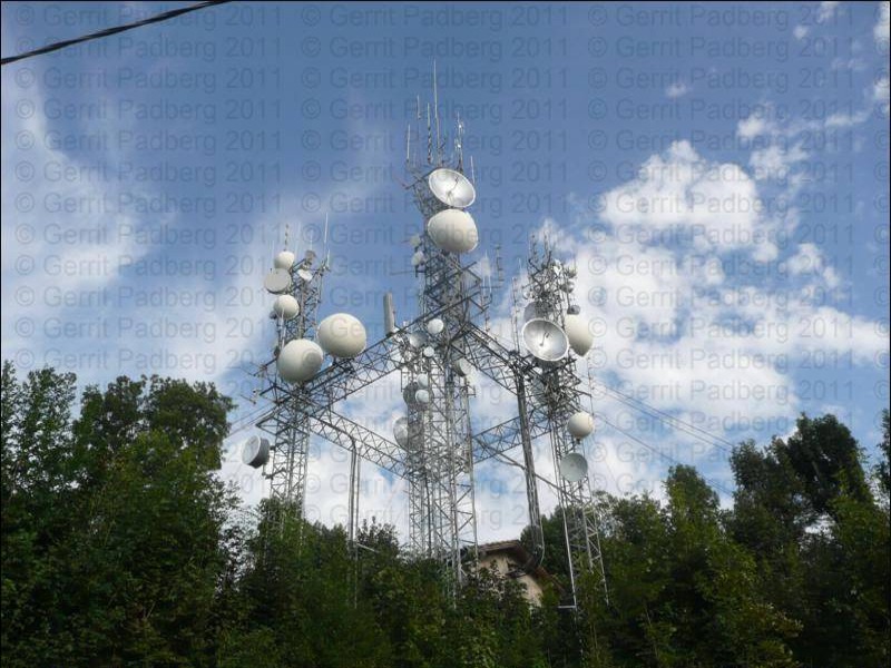
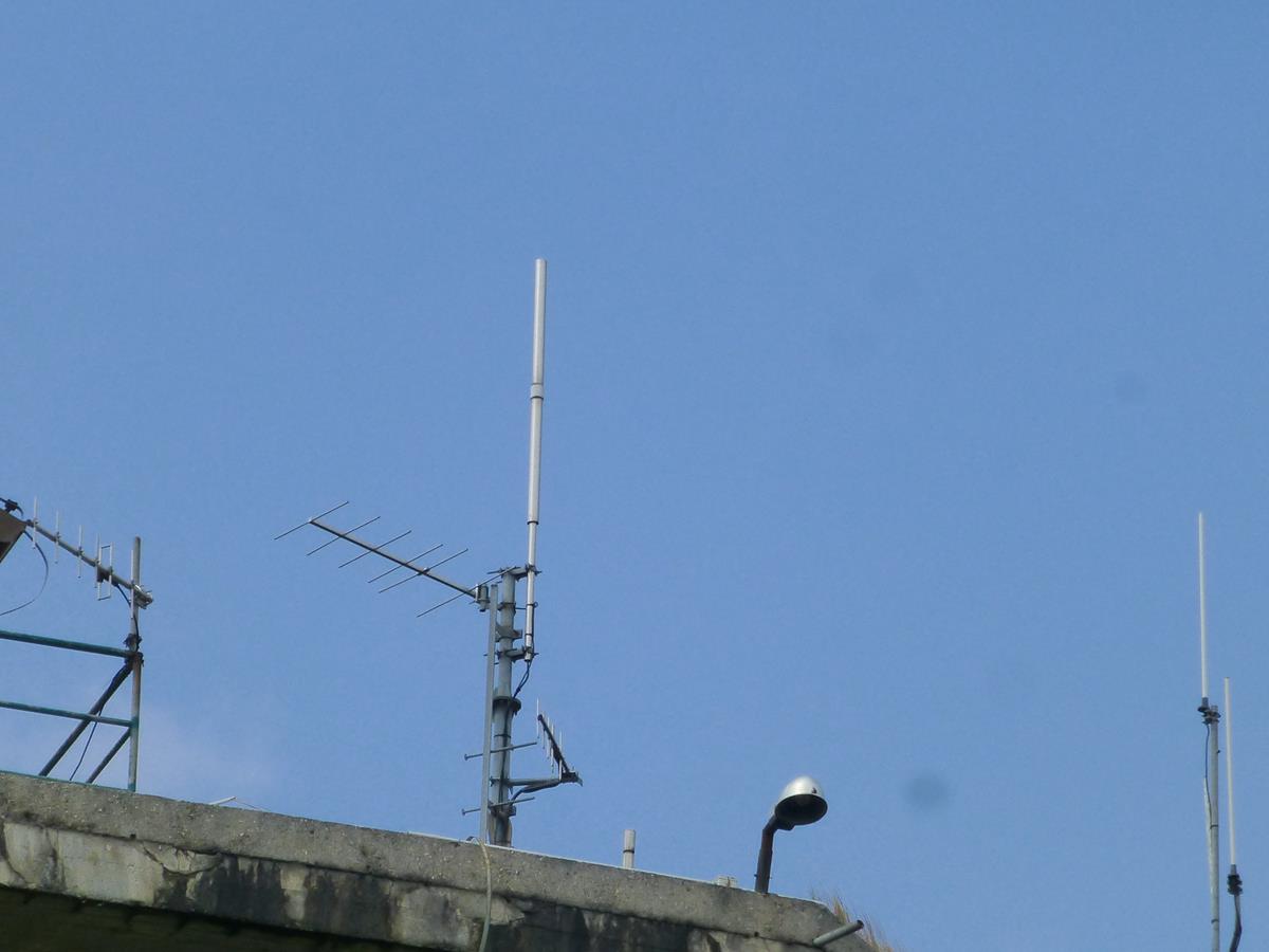
Brescia - Station Monte Maddalena
Position : 45°32'58.13"N/10°17'09.91"O - 847 m.üNN
Site : D
Status : Aufgegebene Nutzung
_________________________________________________________________________________________________________________________________________
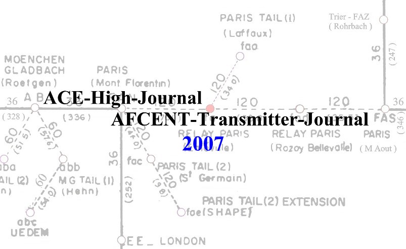
Übersichtspläne - Bezeichnungen - Transmitterverbindungen

_________________________________________________________________________________________________________________________________________
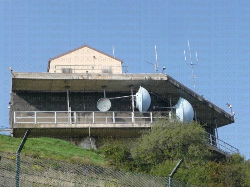
Bilddokumentationen, 2007, 2011


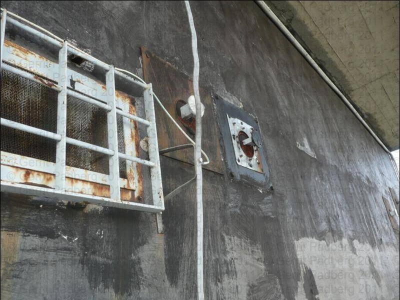
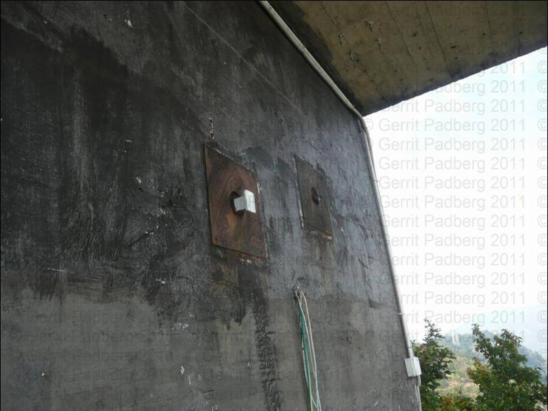
Bilddokumentationen, 2019
_________________________________________________________________________________________________________________________________________
Beschreibungen

"Locales nationales NATO System - Station Monte Maddalena" - die Daten
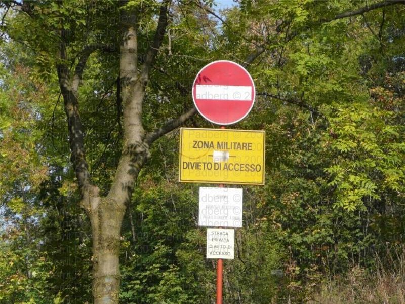
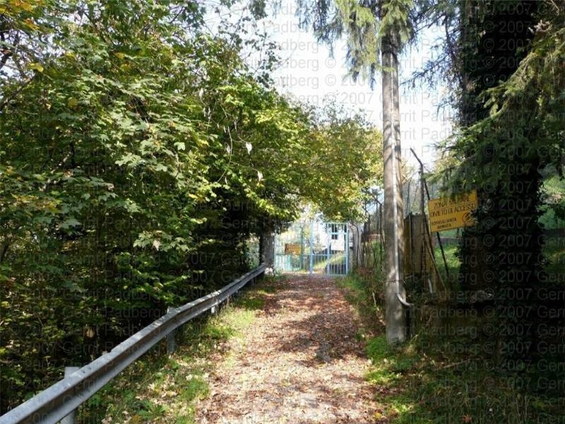
"Locales nationales NATO System - Station Monte Maddalena" - heute (1)
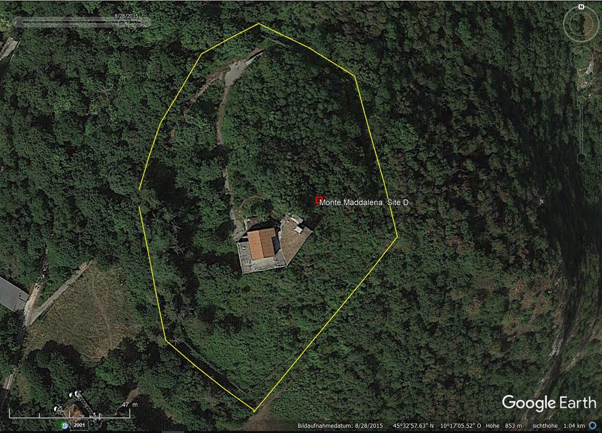
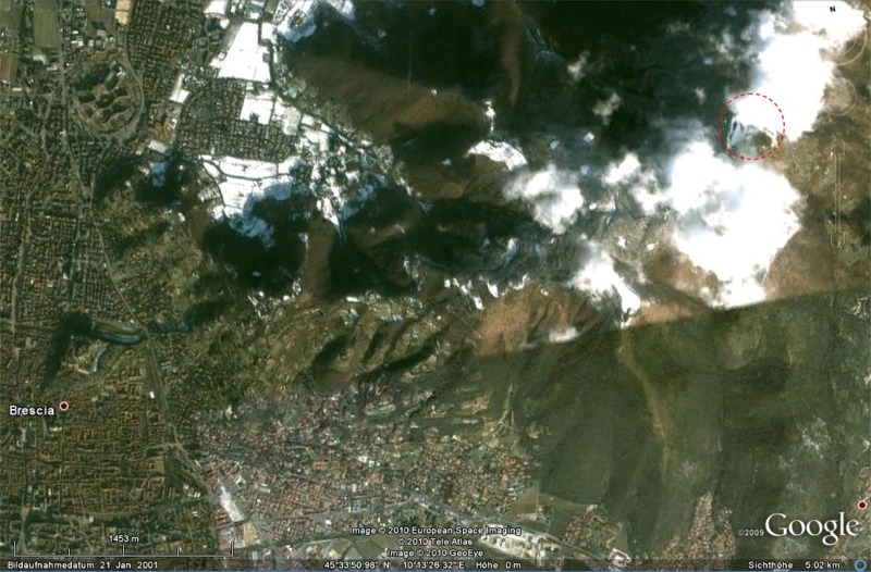
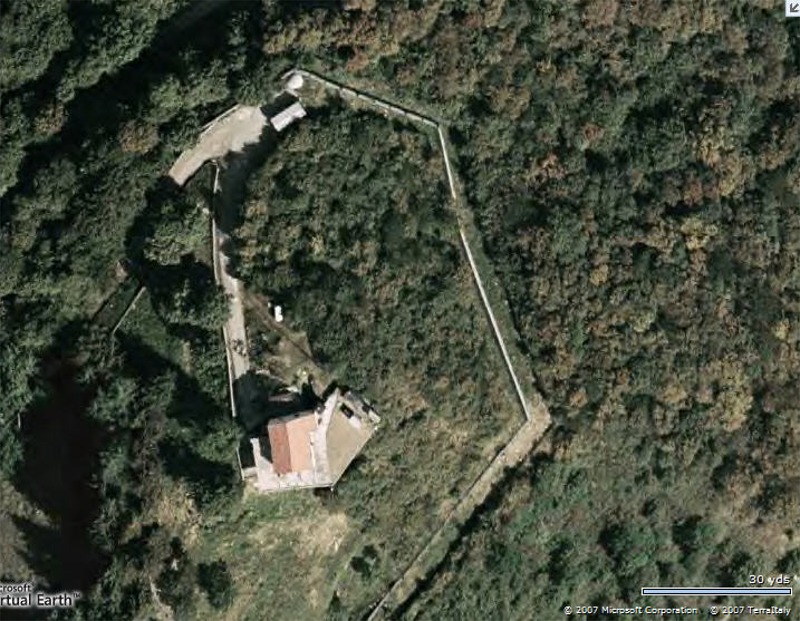
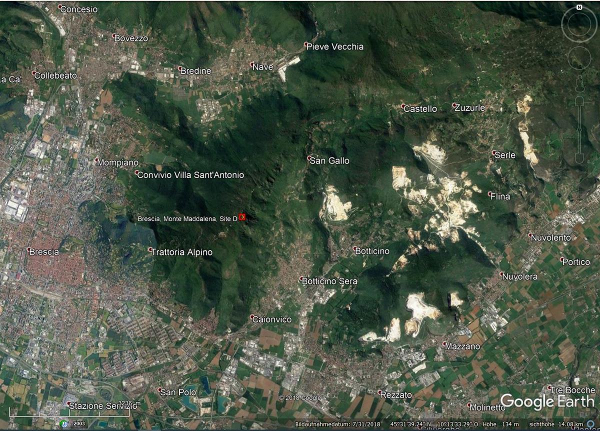
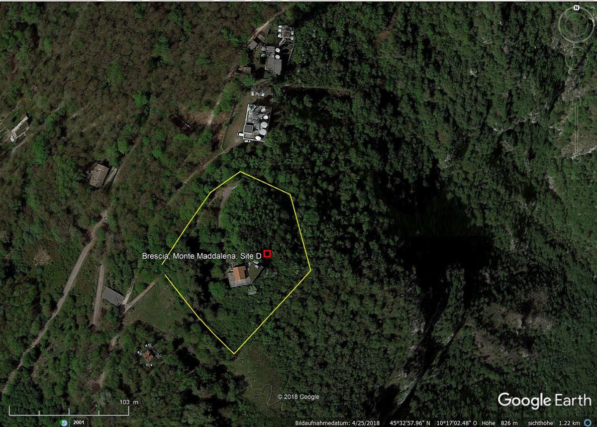
- 2015, Das Gelände der Liegenschaft, ist unter Google Earth erkennbar.
__________________________________________________________________________________________________________________________________________

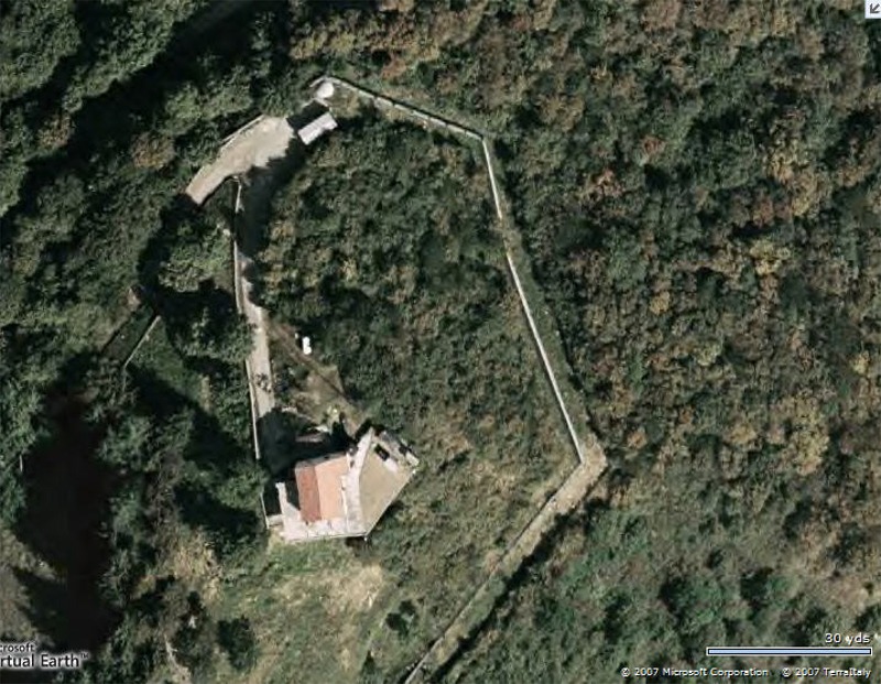
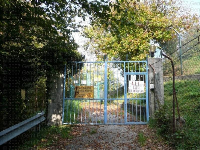
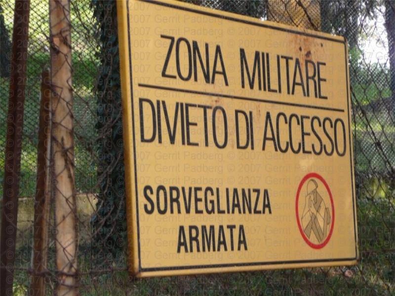
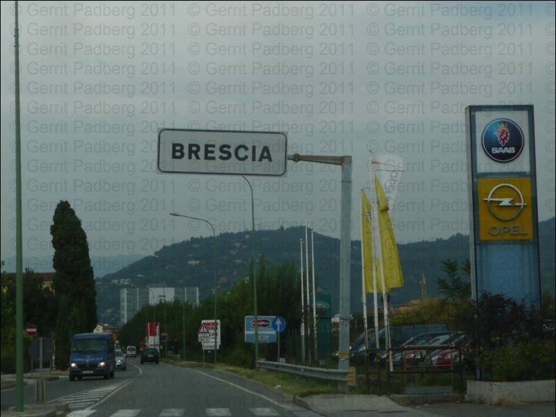
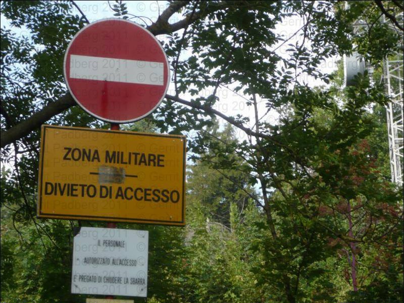
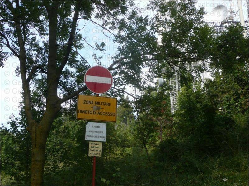
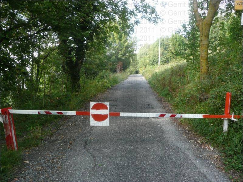
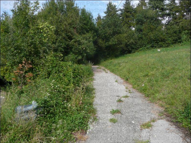
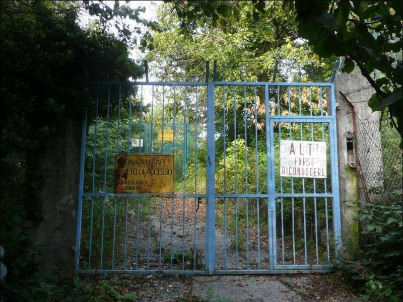
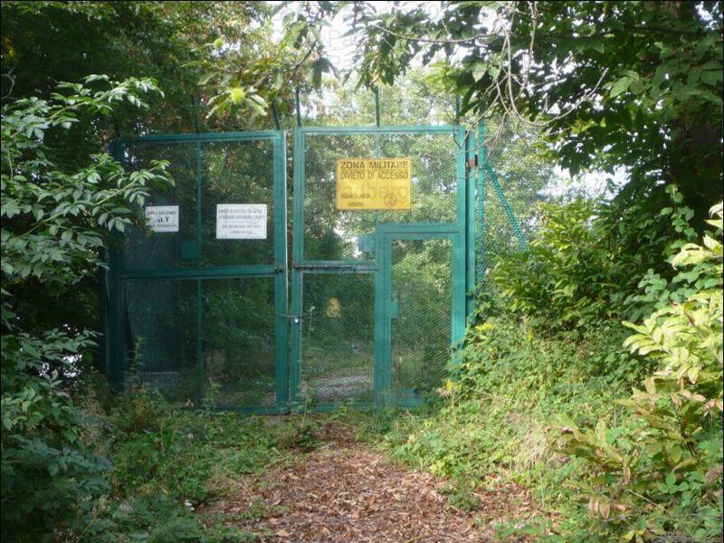
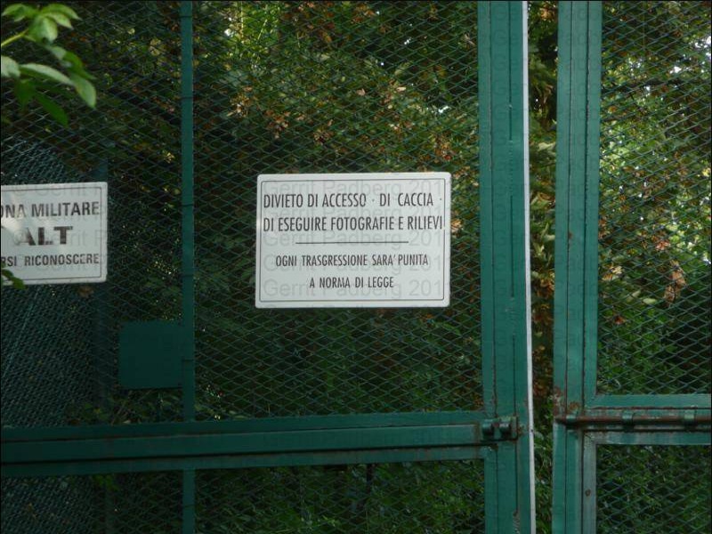
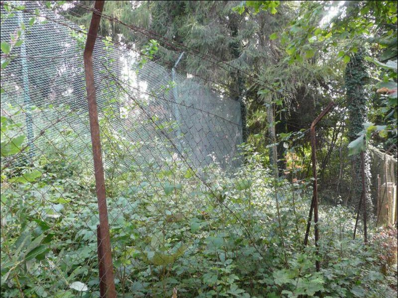
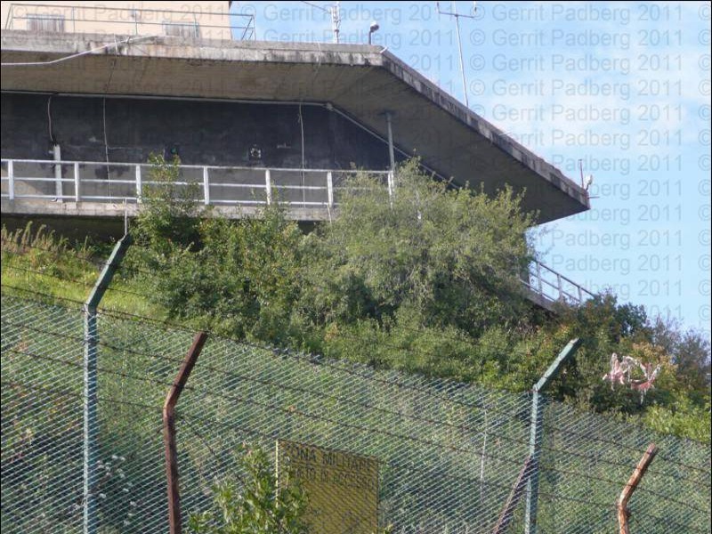
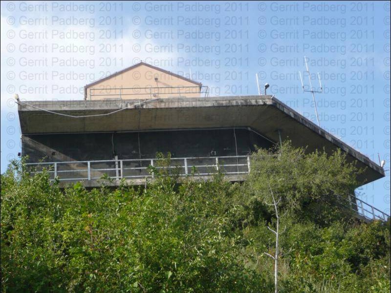
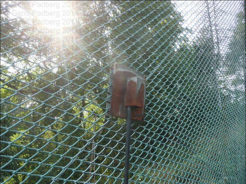
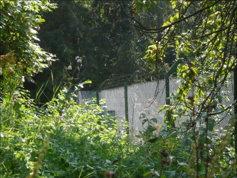
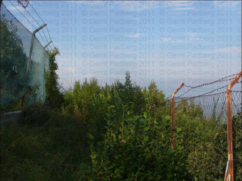
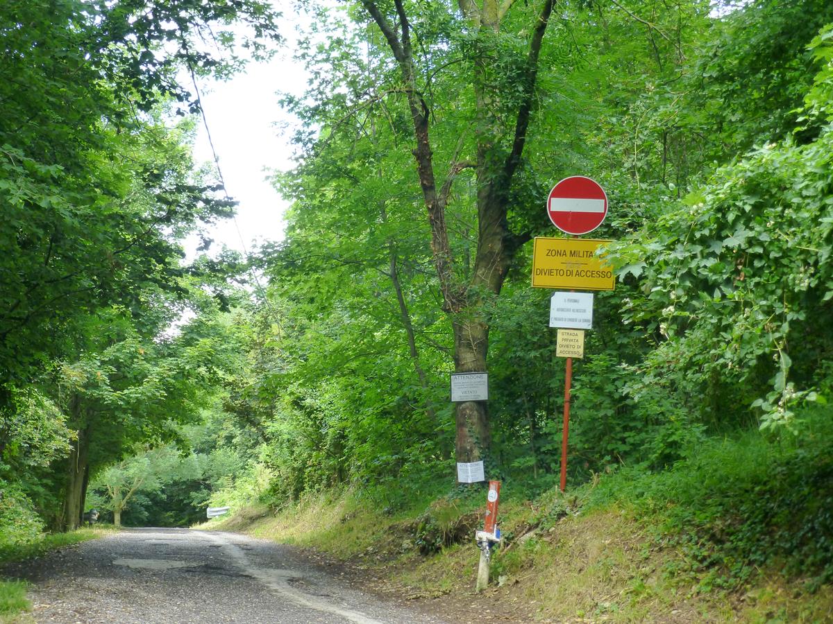
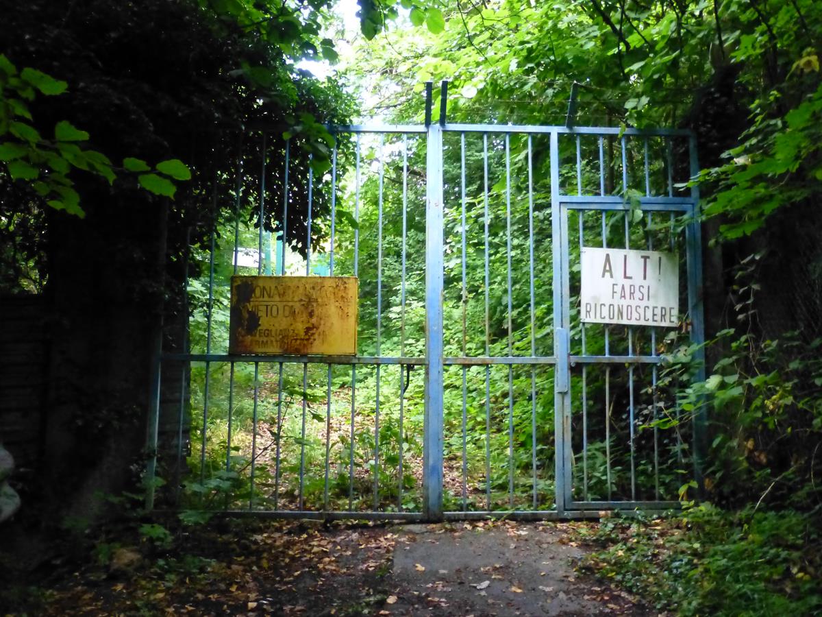
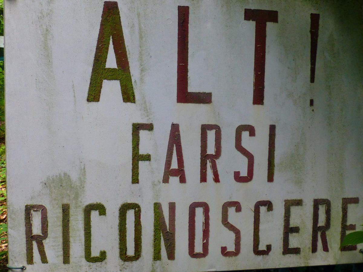
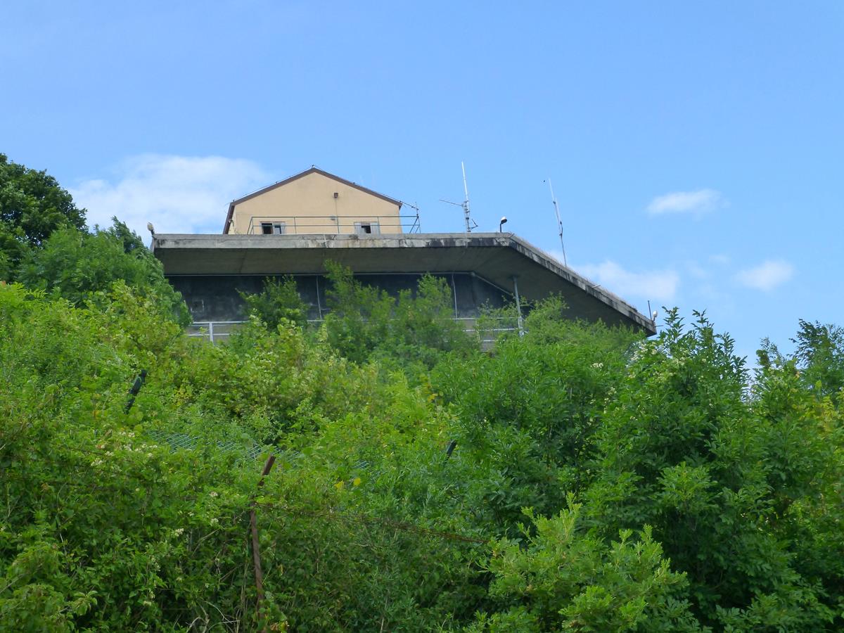
- 2011, Zufahrt zu der Liegenschaft
________________________________________________________________________________________________________________________________________________________
Bild - Quellenangaben
(1) Google Earth/Google Street
_______________________________________________________________________________________________________________________________________________________
Text - Quellenangaben
[1]Wikipedia, Allied Joint Force Command Naples